Scottsdale Airpark | Commercial Real Estate | Zoning

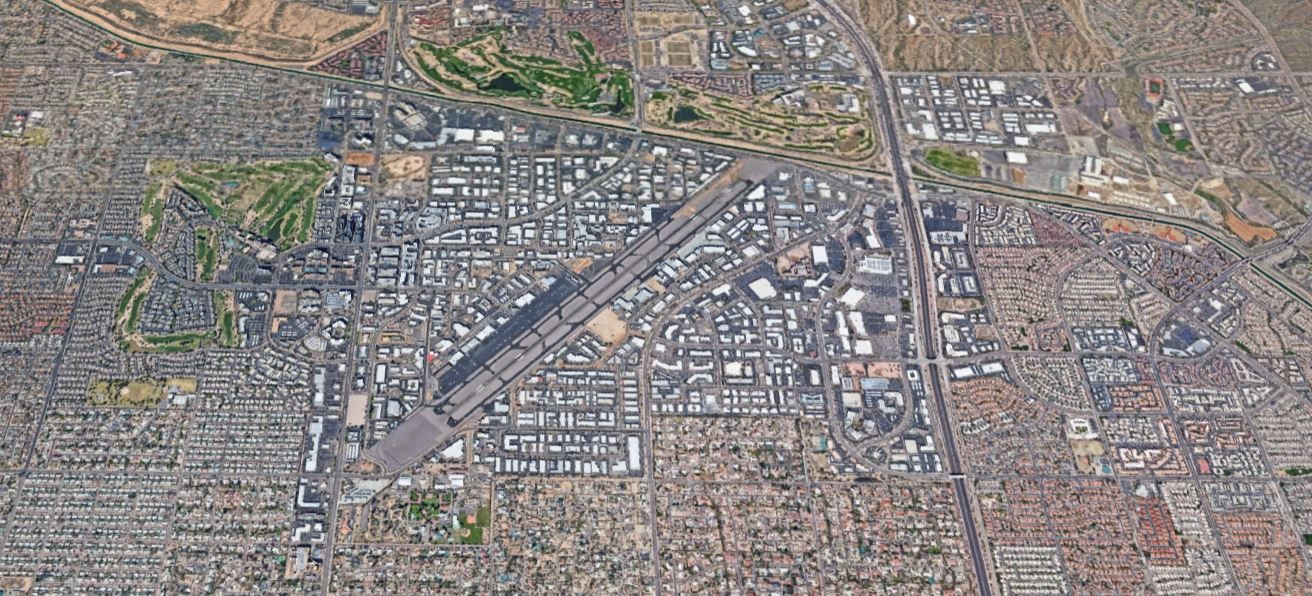
Zoning plays a crucial role in shaping the commercial real estate landscape. Common zoning in the Scottsdale Airpark (specifically near “SDL” – Scottdale, AZ Airport) can typically be seen as I-1 (industrial park district) in particular. Followed by a mix of neighborhood commercial (C-1), central business (C-2), highway commercial (C-3), and general commercial (C-4) to name a few. Allowing for a blend of commercial, office, and light industrial activities. This zoning flexibility attracts a diverse range of tenants, making the Scottsdale Airpark a hub for businesses.
Among the most common tenants are corporate offices, tech companies, aviation-related businesses, and high-end retail establishments nearby. The Airpark’s strategic location and business-friendly zoning have also attracted a significant number of luxury car dealerships and showrooms.
Surrounding the Scottsdale Airpark, notable plazas include Kierland Commons and Scottsdale Quarter, both upscale shopping and dining destinations. These plazas contribute to the overall appeal of the area, making it an attractive location for businesses looking to benefit from the affluent local demographic.
From a commercial real estate standpoint, zoning regulations have a substantial impact. Zoning determines the allowable uses of a property, affecting its value and potential income streams. Diverse zoning, as seen in the Scottsdale Airpark, allows for a combination of commercial activities, fostering a dynamic and vibrant business environment.
In general, zoning regulations can influence property values, development potential, and the overall character of a commercial area. For real estate investors and developers, understanding zoning laws is essential for making informed decisions and navigating the regulatory landscape. Zoning considerations also play a crucial role in determining the compatibility of businesses within a specific area, ensuring a harmonious and sustainable mix of land uses.
Click here to check out an interactive Scottsdale, Arizona zoning map.
Considering selling, leasing, or investing in commercial property? Contact VANDEWEERD today! We’re here to help you thrive.
Post Image: Google Earth version unknown. Imagery from the dates: (“10/26/2013 – 10/31/2022”). Image details – Scottsdale, Arizona. 33°36’39″N 111°54’59″W, 430 m. Available through: URL. Accessed date: 11.28.2023
Disclaimer: The information provided is for general informational purposes only and does not constitute legal or professional advice. Zoning regulations are subject to change, and the details provided may not encompass the full scope or accuracy as of present. It is essential for individuals or entities considering real estate transactions or development projects (etc.) in the Scottsdale Airpark to conduct their own thorough research (i.e. – consulting with the city of Scottsdale with zoning related questions). Any decisions or actions taken based on the provided information are at the sole discretion and risk of the reader. The author and associated entities disclaim any liability for inaccuracies, omissions, or changes in zoning regulations that may/have occur(red).


